
This
Region includes Bucks, Chester, Chester-Delaware, Chester-Lancaster, Lehigh,
Montgomery,
Northampton,
& Philadelphia Counties!
click on small photos to see larger photo!
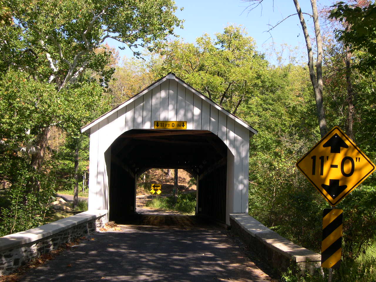
| BUCKS COUNTY |
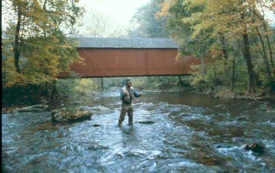 |
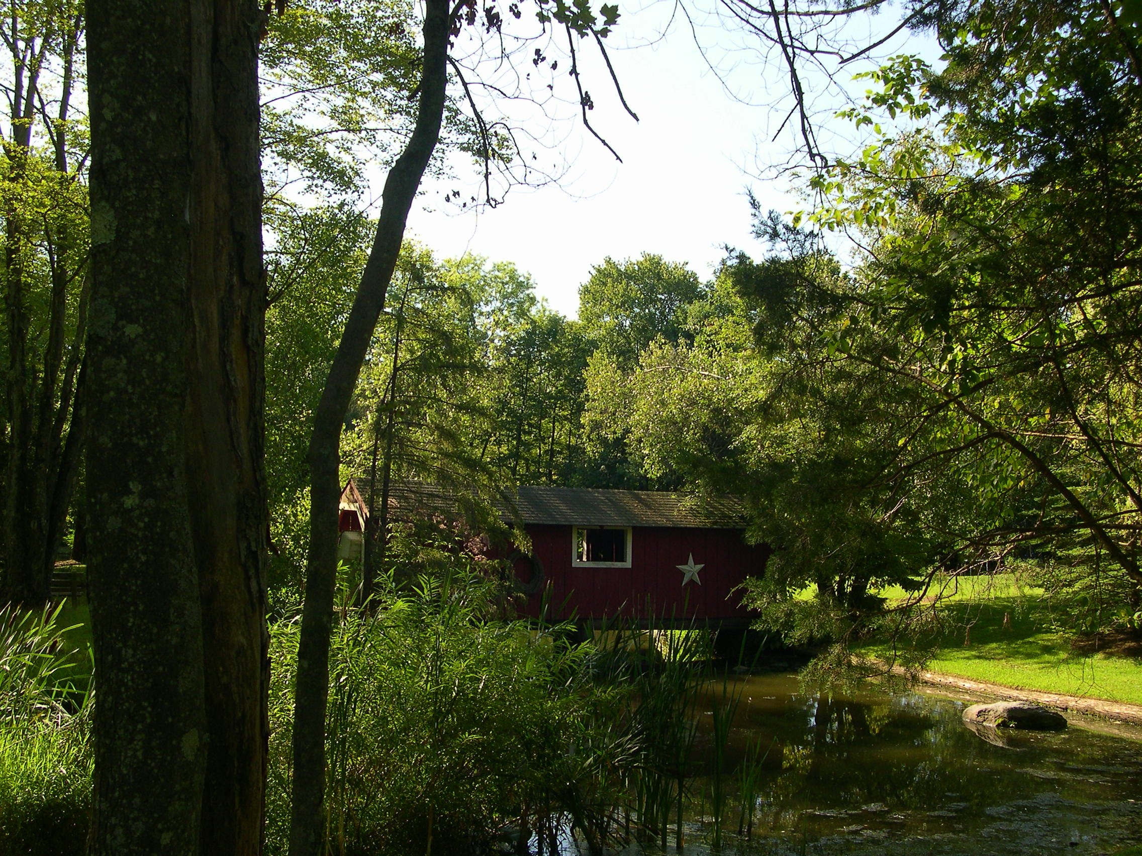
HAUPT'S MILL BRIDGE 38-09-01, Town Truss, builder unknown, built in 1872. It was located in Durham, destroyed by arson on Jan 14, 1985. This photograph was given to me by a friend after telling him that I had just photographed all the covered bridges left in Bucks County. The man fly fishing was his subject. The GPS location was N40 34.11 W75 15.020. (approximate) |
 |
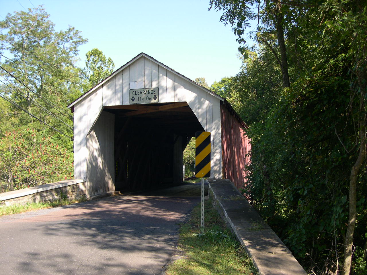
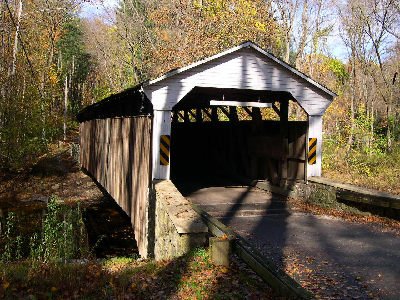
KNECHT'S, SLEIFER BRIDGE 38-09-02, Town Truss, builder unknown, built in 1873, is located on Twp. Rte. 418 west of Durham, on Knecht's Road. The GPS location is N40 32.281 W75 16.667. |
 |
VAN SANT, BEAVER DAM BRIDGE 38-09-03, Town Truss, built by G. Arnst & P. S. Naylor in 1875. It is located on Covered Bridge Road TR392 west of Washington Crossing State Park. The GPS location is N40 19.623 W74 57.469. |
 |
ERWINNA BRIDGE 38-09-04, Town Truss, builder unknown built in 1871, is located on Geiger Hill Road SR1012 in Erwinna. The GPS location is N40 30.139 W75 04.427. |
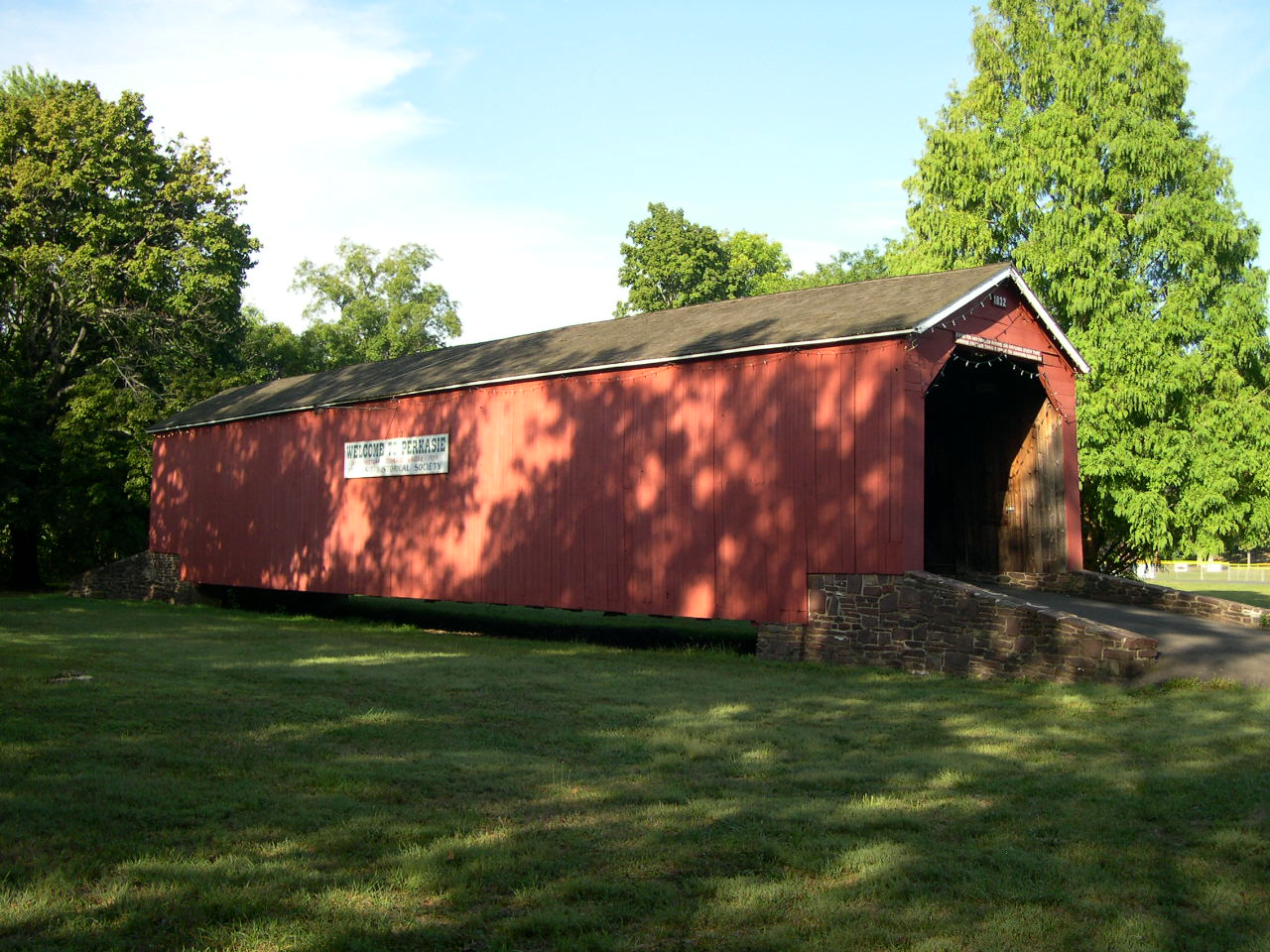 |
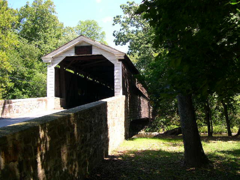
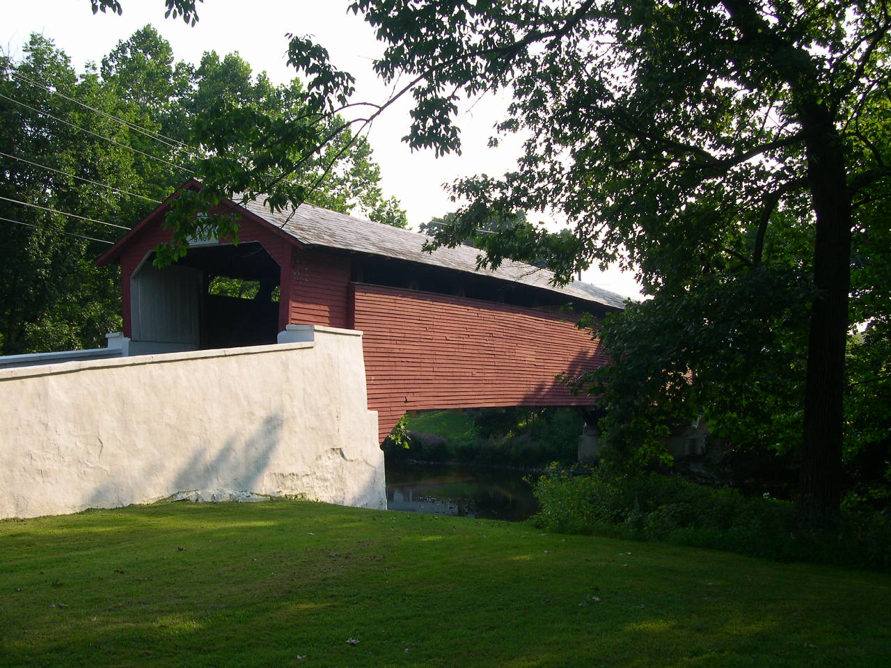
SOUTH PERKASIE BRIDGE 38-09-05, Town Truss, builder unknown, built in 1832, moved to present location in 1958, is located in Lenape Park in Perkasie. The GPS location is N40 22.05 W75 17.70. |
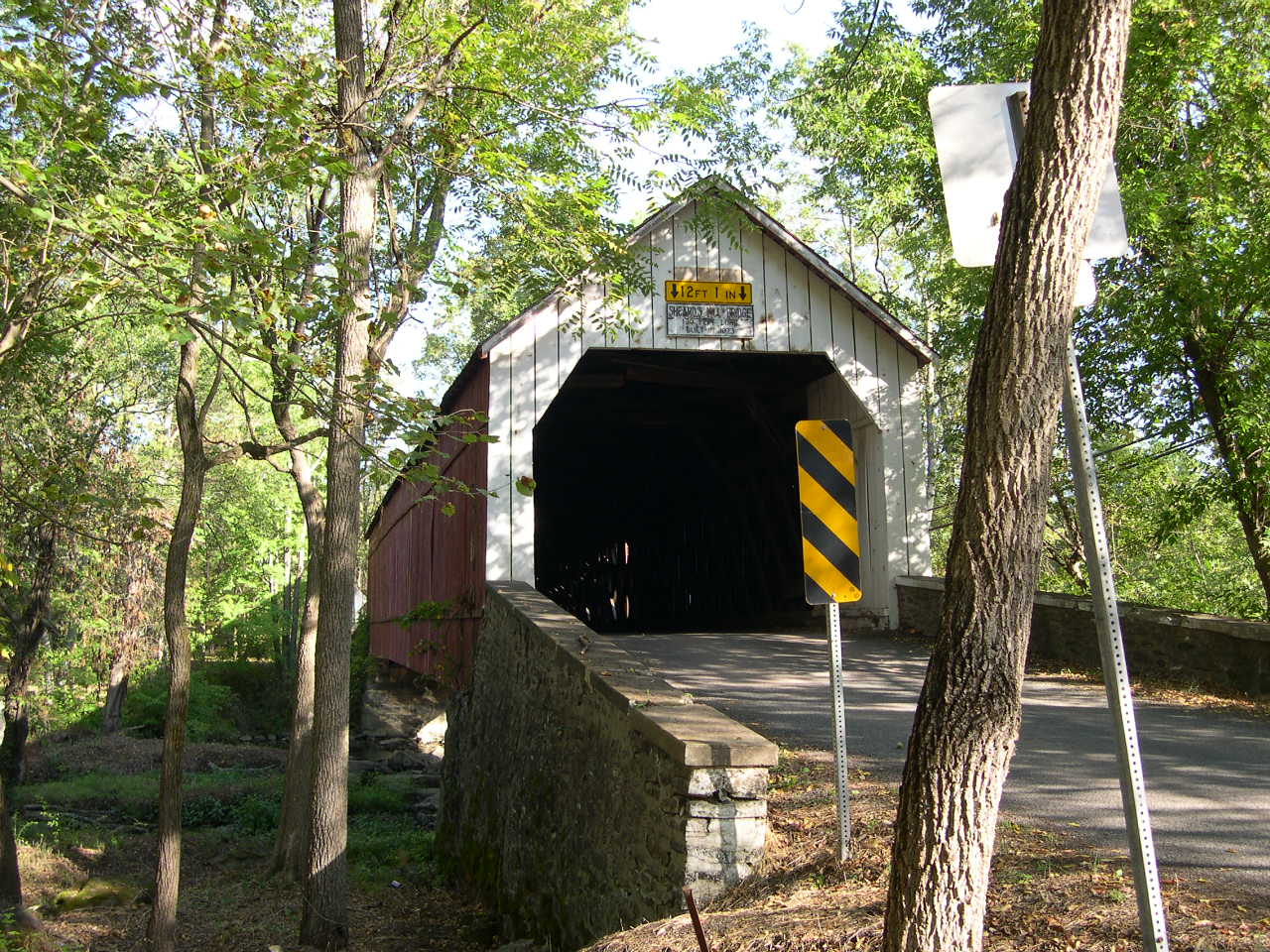 |
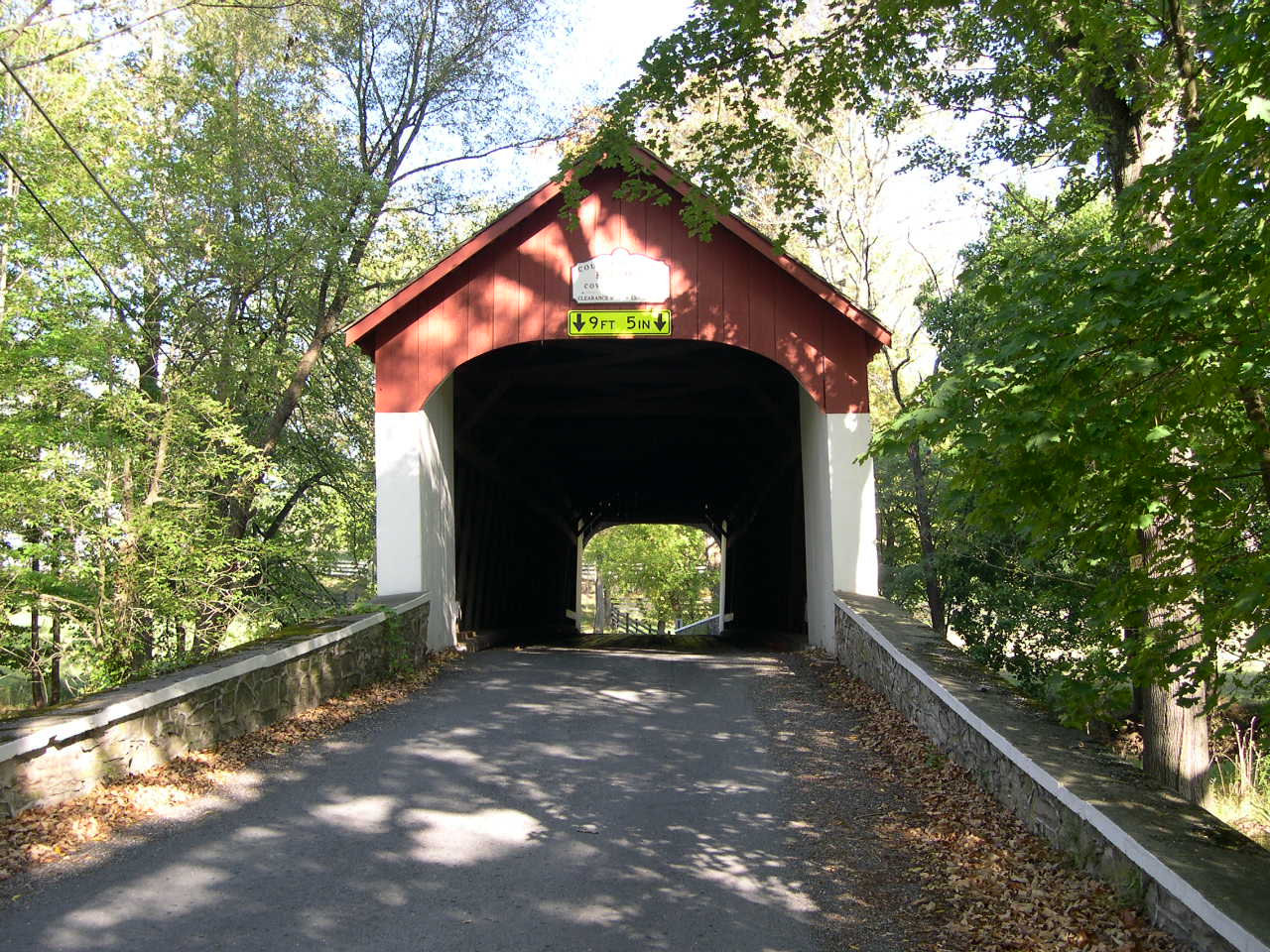
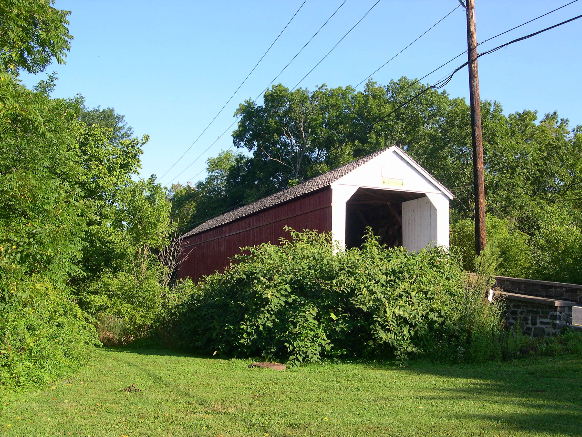
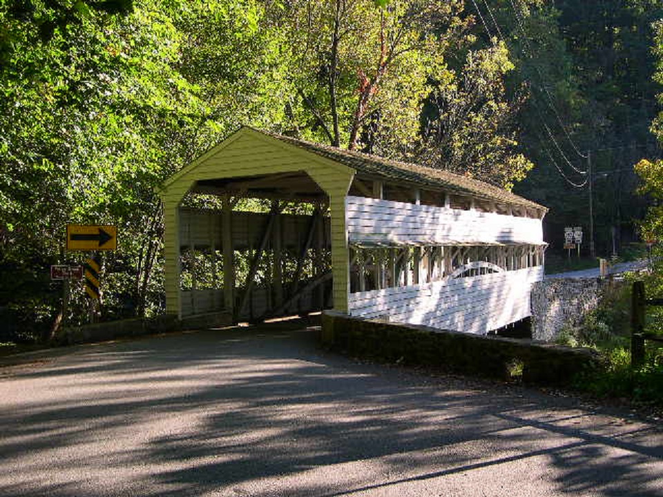
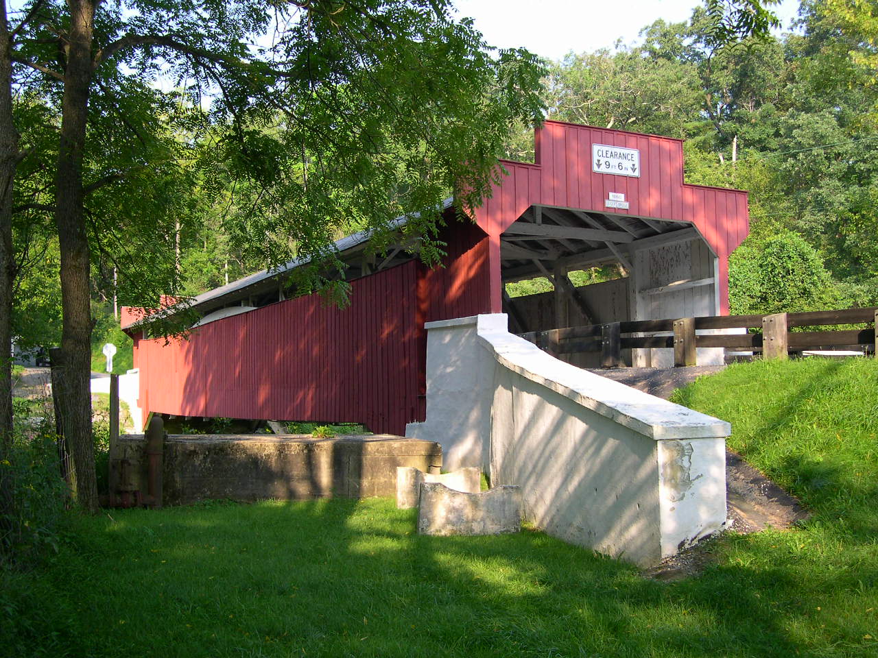
SHEARD'S MILL, THATCHER BRIDGE 38-09-06, Town Truss, builder unknown, built in 1873. It is located on Thatcher Road (SR4099) in Thatcher. The GPS location is N40 27.30 W75 16.71. |
 |
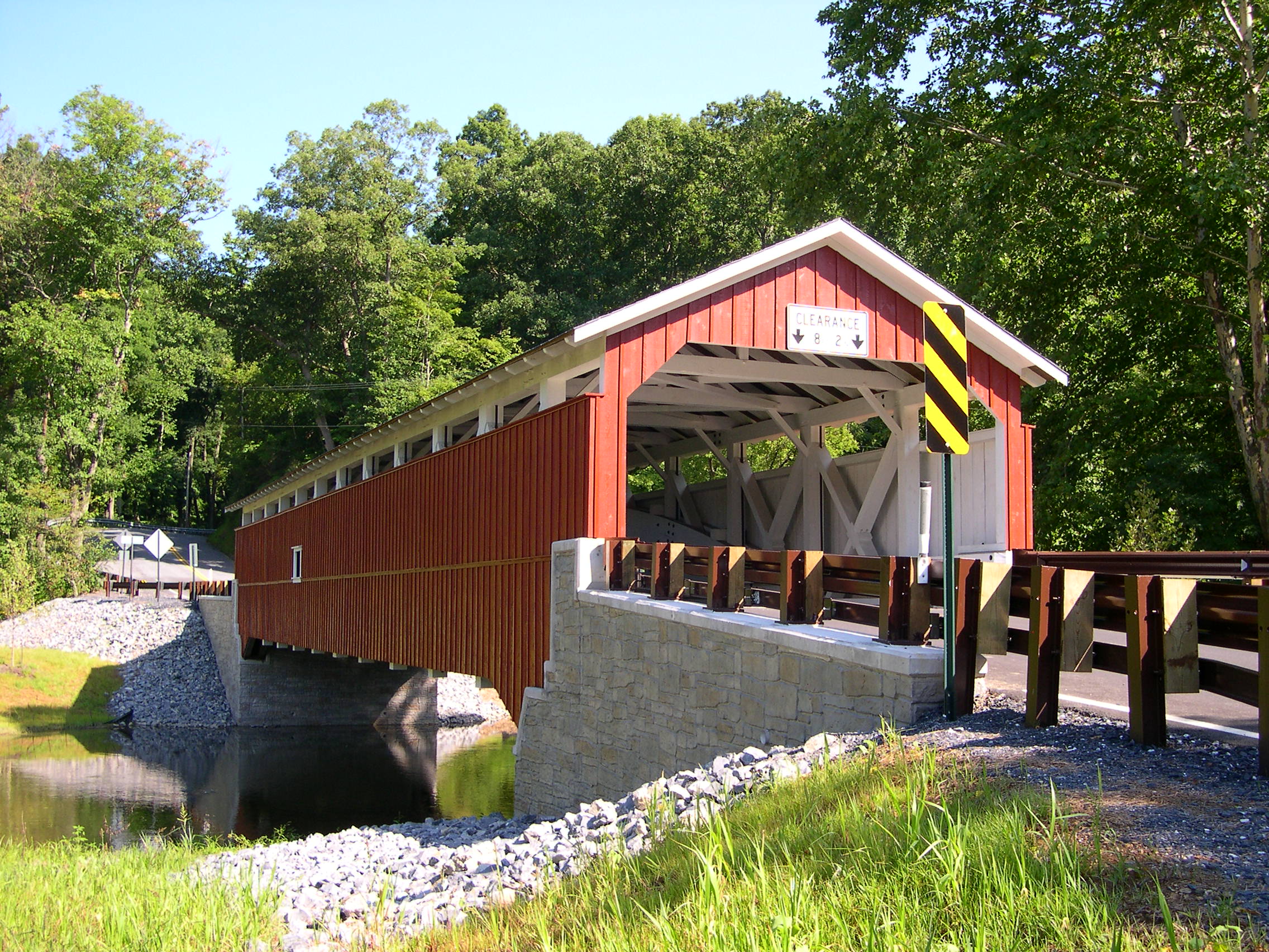
MOOD'S, BRANCH BRIDGE 38-09-07#2, Town Truss, builder unknown, built in 1874. It is located on Blooming Glen Road (SR4089) East of Perkasie. It was completely destroyed by arsonists on June 21, 2004. It has been completely rebuilt. The GPS location is N40 22.874 W75 16.300. |
 |
UHLERSTOWN, LOCK 18 CANAL BRIDGE 38-09-08, Town Truss, builder unknown, built in 1832. It is located on Uhlerstown Hill Road (TR443) in Uhlerstown. The GPS location is N40 31.506 W75 04.377. |
 |
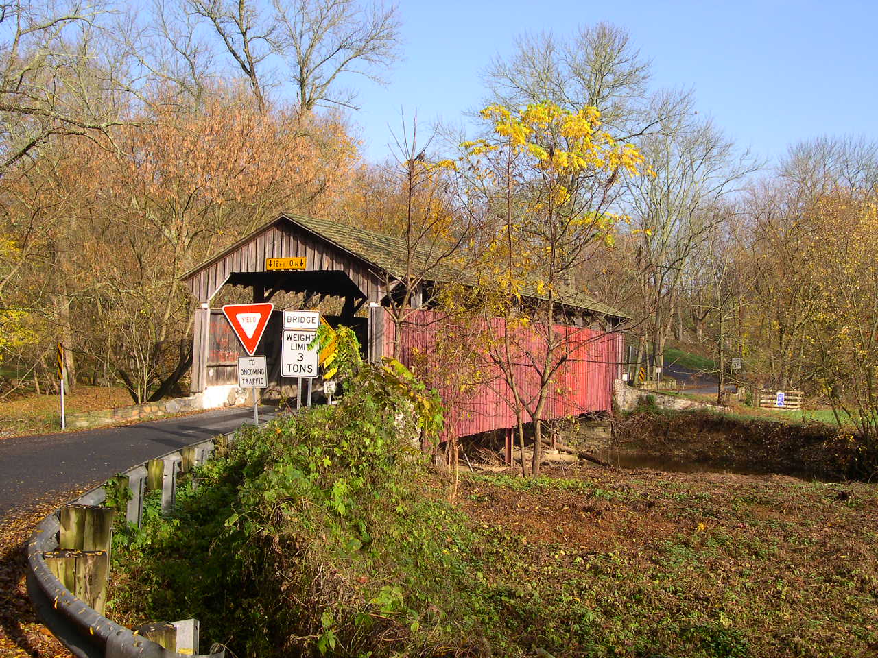
FRANKENFIELD BRIDGE 38-09-09, Town Truss, built by David Sutton in 1872. It is located on Hollow Horn Road (TR440) south of Sundale. The GPS location is N40 28.53 W75 05.96. |
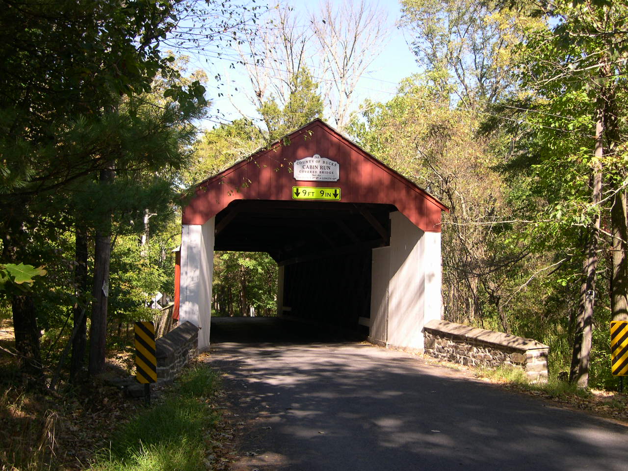 |
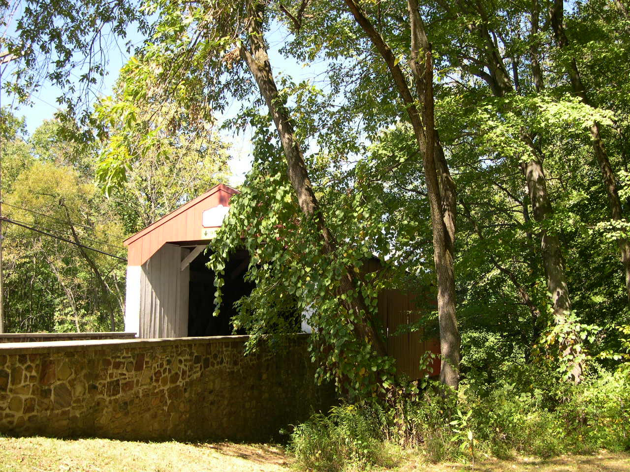
CABIN RUN BRIDGE 38-09-10, Town Truss, built by David Sutton in 1874. It is located on Covered Bridge Road (TR416), west of Ralph Stover State Park in Plumstead Township. The GPS location is N40 25.919 W75 06.751. |
 |
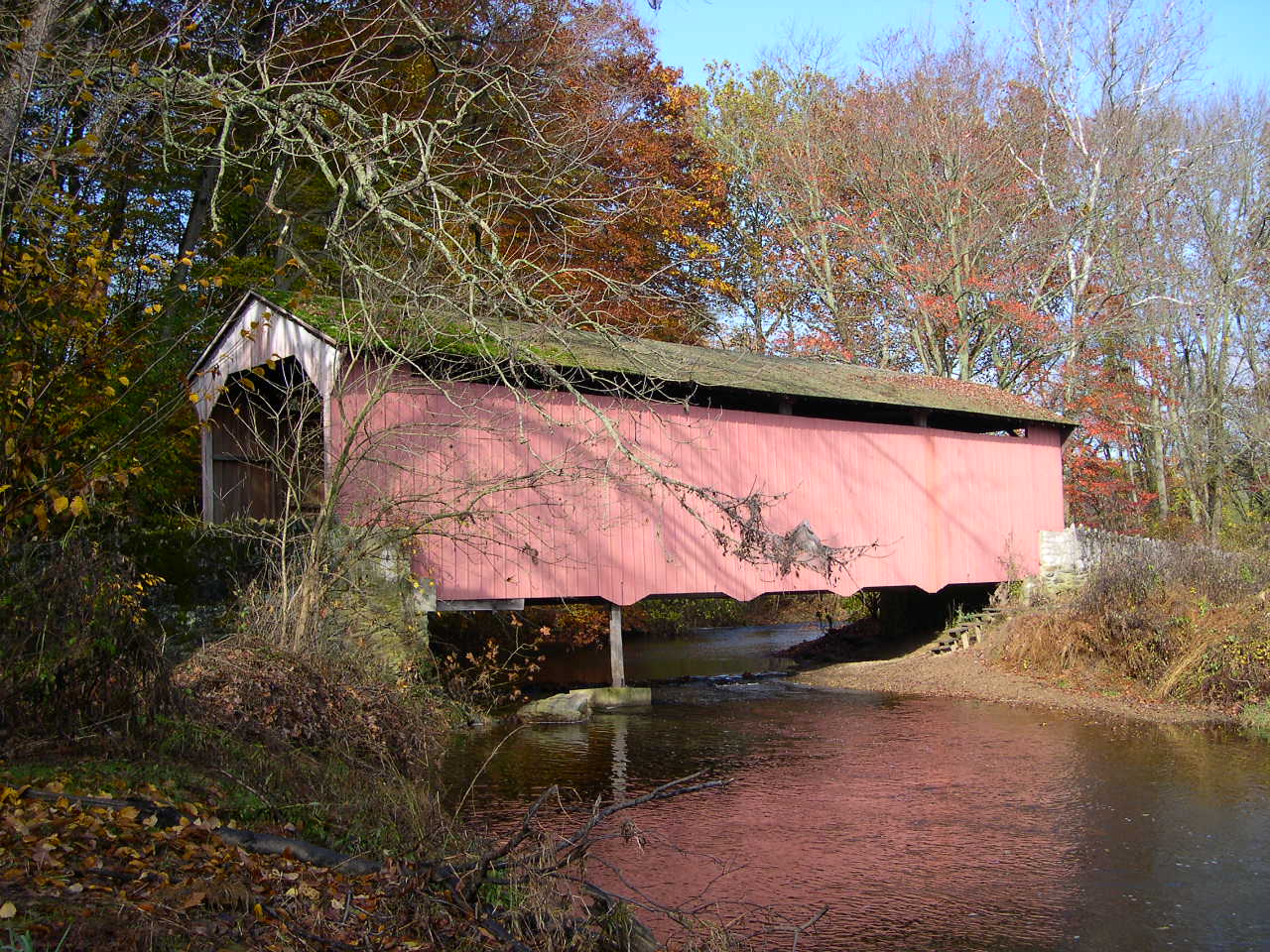
LOUX, LOUX MILL FORD BRIDGE 38-09-11, Town Truss, built by David Sutton in 1874. It is located on Carversville-Wismer Road (SR1003), southeast of Pipersville. The GPS location is N40 25.373 W75 07.644. |
 |
PINE VALLEY, IRON HILL BRIDGE 38-09-12, Town Truss, built by David Sutton in 1842. It is located on Keeley Avenue (TR340), in New Britain. The GPS location is N40 18.33 W75 11.25. |
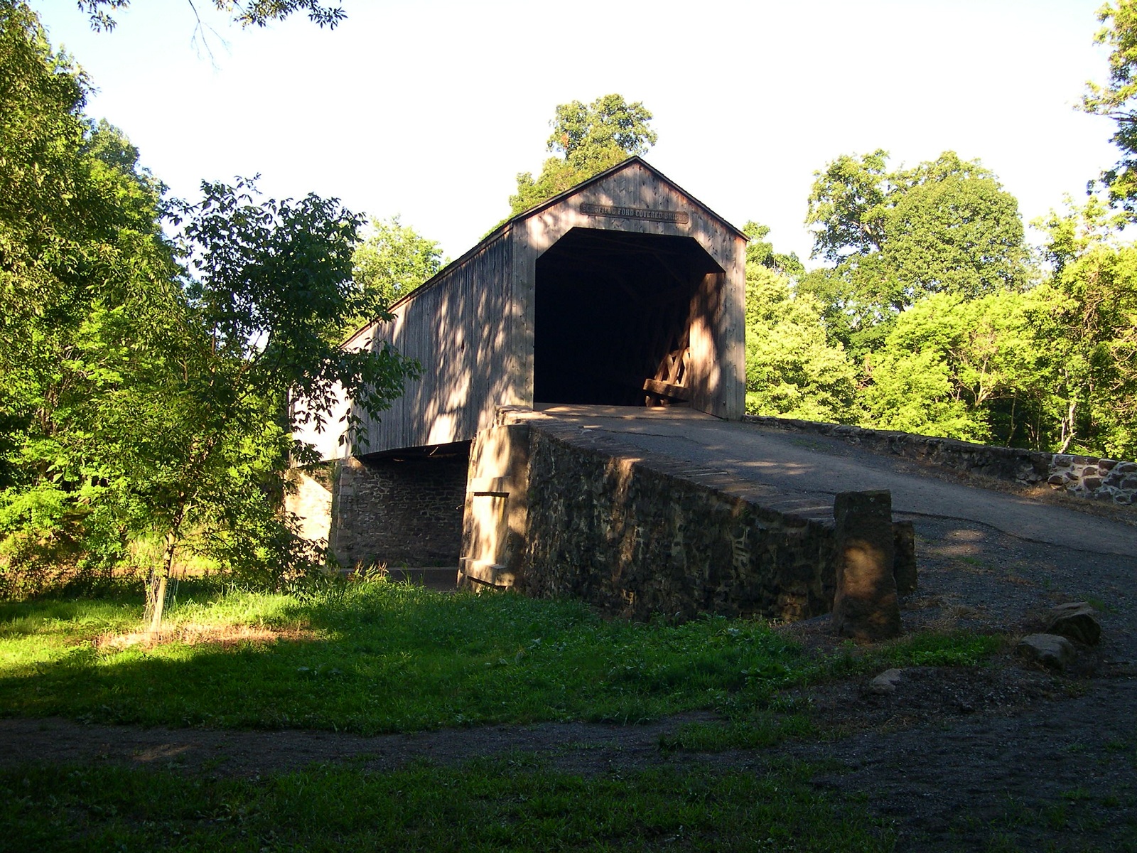 |
TWINING FORD, SCHOFIELD FORD BRIDGE 38-09-13#2, Town Truss, builder & date built unknown was destroyed by fire on Oct. 8, 1991 and re-built in Sep. 6,1997. It is located in Tyler State Park. The GPS location is N40 14.65 W74 58.81. |
 |
SHUBERT BRIDGE 38-09-c, Stringer, (Private) a 45-ft. Footbridge built over a small pond in 1974 is located along Hickon Road, on the east side of the road in Richland Twp. Please ask permission to visit. The GPS location is N40 29.21 W75 21.61. |
 |
TOHICKON AQUEDUCT 38-09-P2#2, Burr Arch Trusses, Point Pleasant , Pa. virtually looks like a covered bridge from a distance, but actually carries canal water across another body of water. Worth seeing if you are a "bridger". Built with trusses like a covered bridge. The GPS location is N40 25.34 W75 03.90. |
| CHESTER COUNTY |
 |
RUDOLPH & ARTHUR BRIDGE 38-15-01, Burr-Arch Truss, built by Menander Wood & Richard T. Meredith in 1880. It is located on Rudolph's Camp Road (TR307), North of Pa-Md state line. The GPS location is N39 44.73 W75 52.93. |
 |
GLEN HOPE, ELK MILLS, ANDERSON'S FORD BRIDGE 38-15-02, Burr-Arch Truss, built by Menander Wood & George E. Jones in 1889. It was destroyed by fire in 1987 & has been re-habilitated. It is located SSE of Hickory Hill, on Providence Road. The GPS location is N39 43.62 W75 54.45. |
 |
LINTON STEVENS, LINTON STEPHENS BRIDGE 38-15-03, Burr-Arch Truss, built by Denithorne & Son in 1886. It is located NE of Hickory Hill, on Kings Row Road. The GPS location is N39 45.390 W75 54.742. |
 |
SPEAKMAN #1 BRIDGE 38-15-05, Burr-Arch Truss, built by Ferdinand & Menander Wood in 1881. It is located on Covered Bridge Road (CR3047) South of Ercildoun. The GPS location is N39 55.762 W75 49.353. |
 |
SPEAKMAN #2, MARY ANN PYLE BRIDGE 38-15-06, Queenpost Truss, built by Menander & Ferdinand Wood in 1881. (Private) It is located on the Laurel Reserve, off of Twp. Rte 371 in Doe Run. A membership to the Brandywine Conservancy is required to visit this bridge. The GPS location is N39 55.311 W75 47.997. |
 |
HAYES CLARK BRIDGE 38-15-07#2, Queenpost Truss, built by Buck & Doe Valley Farms in 1971. It is located on the Laurel Reserve, off of Twp. Rte 371 in Doe Run. A membership to the Brandywine Conservancy is required to visit this bridge. The GPS location is N39 55.205 W75 47.917. |
 |
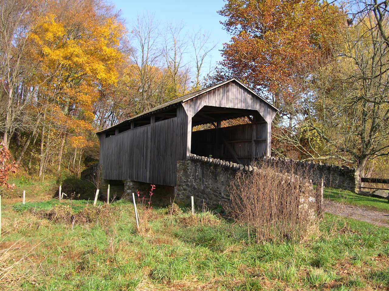
GIBSON'S, HARMONY HILL BRIDGE 38-15-10, Burr-Arch Truss, built by Edward H. Hall & Thomas E. Schull in 1872. It is located on Harmony Hill (TR391). The GPS location is N39 58.57 W75 40.98. |
 |
LARKIN'S MILL BRIDGE 38-15-11#2, Burr-Arch Truss, built by Menander & Ferdinand Wood in 1854 and rebuilt in 1881. It has been moved to Eagle, Pa at the Byers Station Development just East of Route 100 on Graphite Mine Road. The GPS location is N40 04.948 W75 41.133. |
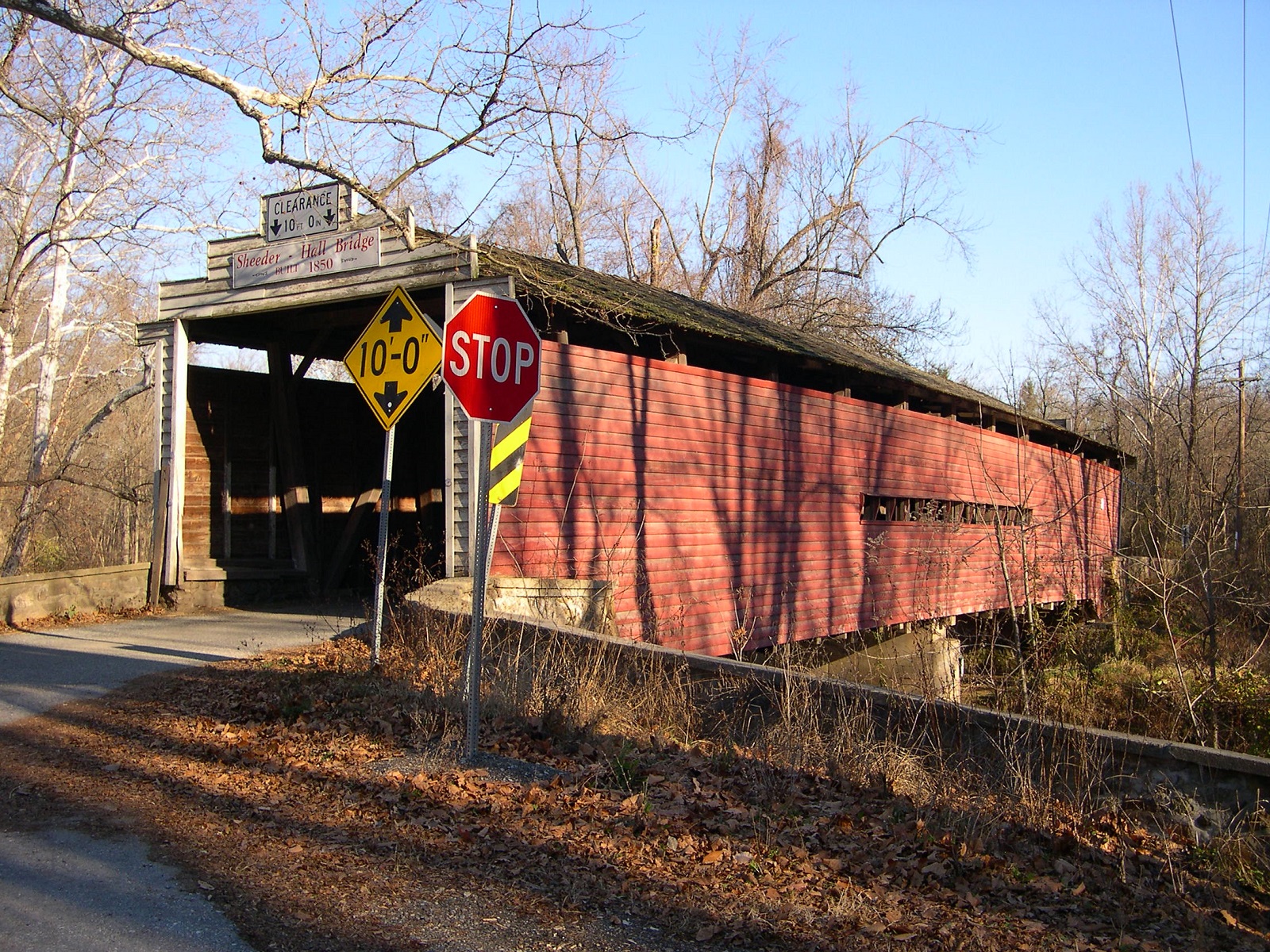 |
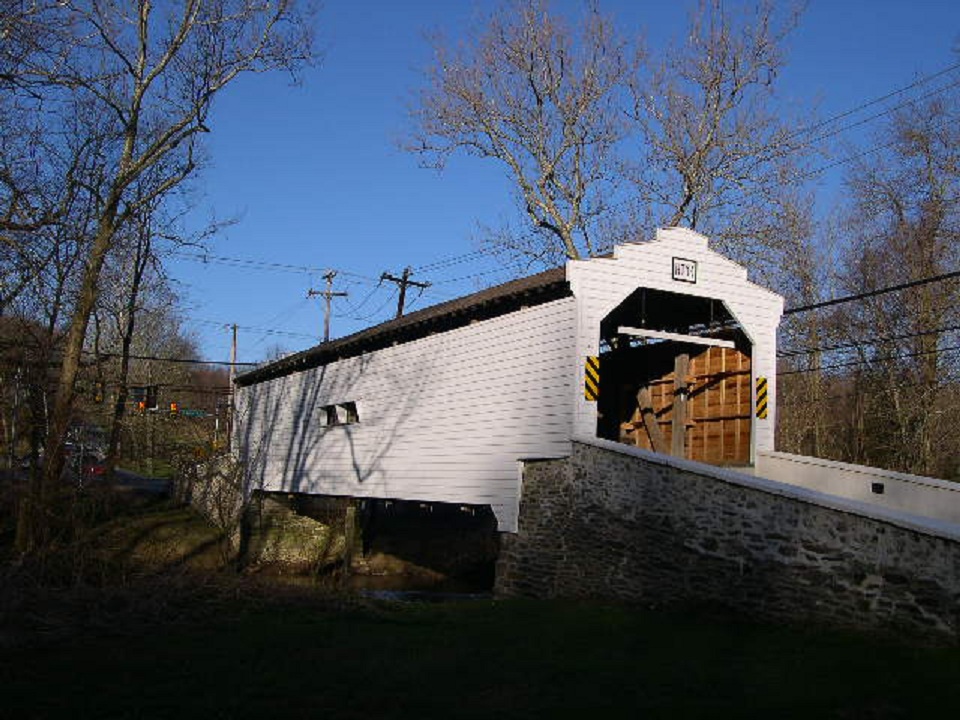
HALL'S, SHEEDER'S BRIDGE 38-15-12, Burr-Arch Truss, built by Robert Russell & Jacob Fox in 1850. It is located on Hollow Road. The GPS location is N40 08.86 W75 37.24. |
 |
KENNEDY BRIDGE 38-15-13#2, Burr-Arch Truss, built by Alex & Jesse King in 1856 and destroyed by fire in 1986. It was rebuilt using bongossi (non-flammable wood) from Africa. It is located North of Kimberton, on Seven Stars Road. The GPS location is N40 08.42 W75 34.58. |
 |
RAPP'S BRIDGE 38-15-14, Burr-Arch Truss, built by Benjamin F. Hartman in 1866. It is located on Rapp's Dam Road. The GPS location is N40 08.29 W75 33.17. |
 |
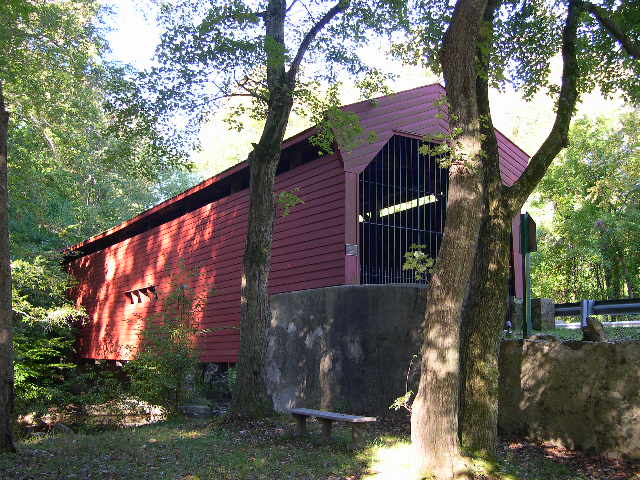
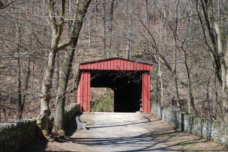
VALLEY FORGE DAM, VALLEY FORGE PARK, KNOX BRIDGE 38-15-15#2, Burr Arch Truss, built by Robert Russell in 1865. It is located in Valley Forge National Historical Park on Yellow Springs Road. It is named after Philander C. Knox (1855-1921) United States Senator from Pa. & General Henry Knox (1750-1806) an officer quartered at Valley Forge during the winter of 1777-1778. In early July of 2015 the bridge was hit by a tractor trailer. The GPS location is N40 05.20 W75 27.35. |
| CHESTER-DELAWARE COUNTY |
 |
BARTRAM'S, SAGER'S GRISTMILL BRIDGE 38-15-17 & 38-23-02, Burr-Arch Truss, is shared by Chester & Delaware counties, built by Ferdinand Wood in 1860. It is located on bypassed section of Goshen Road East of Echo Valley. Private ownership. The GPS location is N39 59.39 W75 26.23. |
| CHESTER-LANCASTER COUNTY |
 |
MERCER'S MILL BRIDGE 38-15-19 & 38-36-38, Burr Arch Truss, built in 1880 by B. J. Carter. It is located on Bailey's Crossraod Road (TR976), South of Christiana. This bridge is shared with Lancaster county. The GPS location is N39 55.89 W75 58.89. |
 |
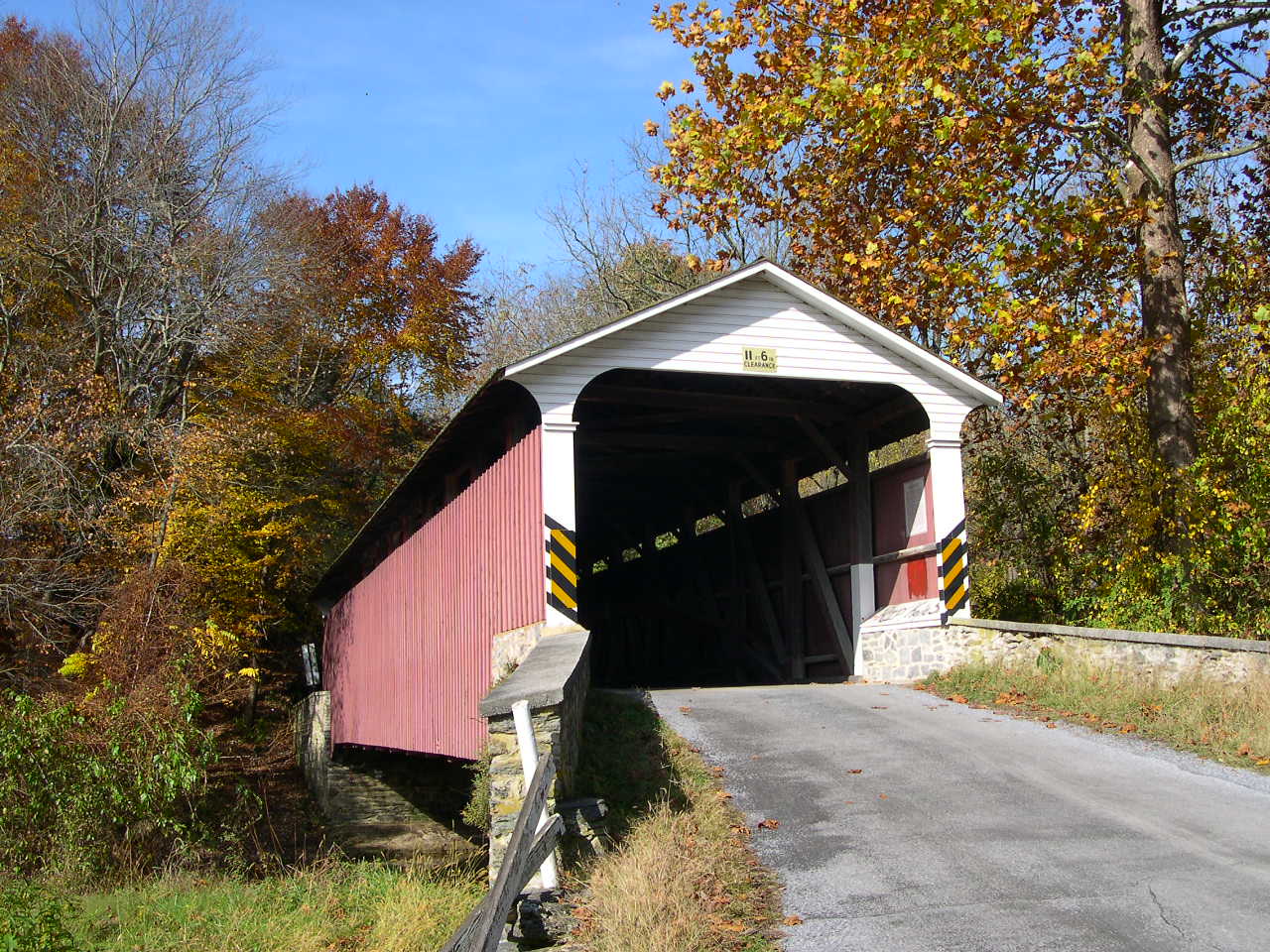
PINE GROVE FORGE, LITTLE BRITAIN BRIDGE 38-15-22#3 & 38-36-41#3, Burr Arch Truss, built by Elias McMellen in 1884. It is located on CR3001 in Pine Grove. This bridge is shared with Lancaster county. It was refurbished in 2008. The GPS location is N39 47.618 W76 02.687. |
| LEHIGH COUNTY |
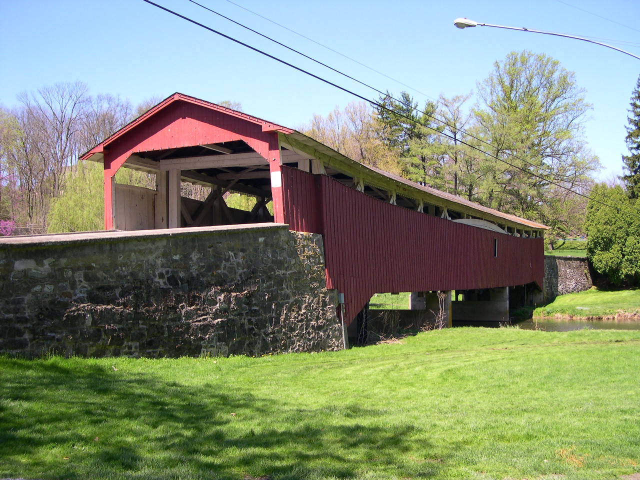 |
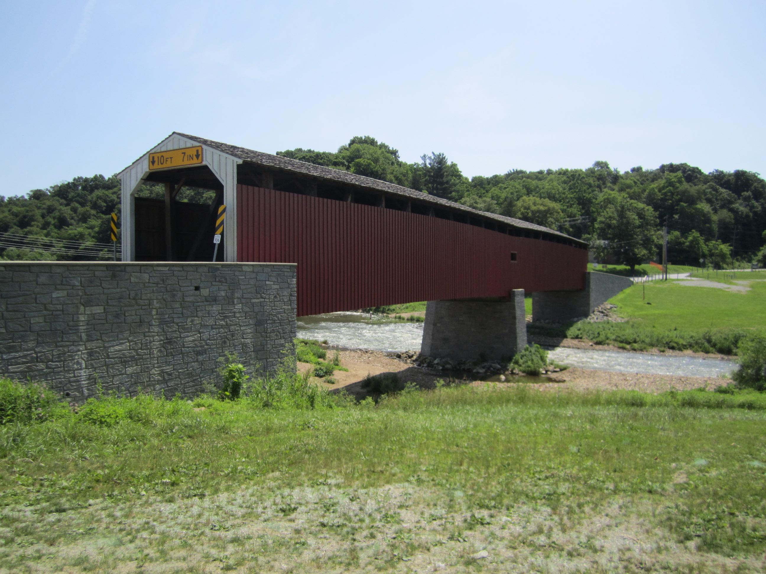
BOGERT'S BRIDGE PA-39-01, Burr-Arch Truss, builder unknown, built in 1841. It is located in Little Lehigh Park, Allentown on bypassed section of Oxford Road CR2007. The GPS location is N40 34.13 W75 29.92. |
 |
WEHR'S BRIDGE PA-39-02, Burr-Arch Truss, builder unknown, built in 1841. It is located on Wehr Mill Road (TR597) NW of Stetersville. The GPS location is N40 37.721 W75 34.186. |
 |
MANASSAS GUTHS BRIDGE PA-39-03, Burr-Arch Truss, builder unknown, built in 1868, & rebuilt in 1882. It is located on Lapp Road (TR602) North of Guth. The GPS location is N40 37.778 W75 33.204. |
 |
REX'S BRIDGE PA-39-04, Burr-Arch Truss, builder unknown, built in 1858. It is located on Jordan Road (TR593) South of Kernsville. The GPS location is N40 38.094 W75 36.757. |
 |
GEIGER'S BRIDGE PA-39-05, Burr-Arch Truss, builder unknown, built in 1860. It is located on Old Packhouse Road (TR681) NE of Weidasville. The GPS location is N40 38.786 W75 37.411. |
 |
SCHLICHER'S BRIDGE PA-39-06 #2, Burr-Arch Truss, builder unknown, built in 1882. It is located on Trexler Game Preserve Road (CR4007) South of Schnecksville. It was rehabilitated in 2014. The GPS location is N40 39.704 W75 37.606. |
 |
TROUT RUN BRIDGE 38-39-g, Stringer, built in 2004, is located in Slatington on 7th Street on the Slate Heritage Trail. The GPS location is N40 44.95 W75 37.13. |
| MONTGOMERY COUNTY |
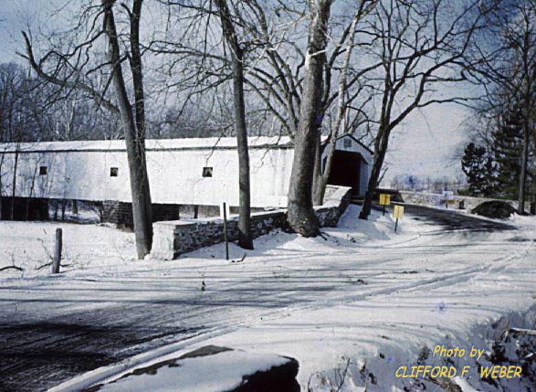 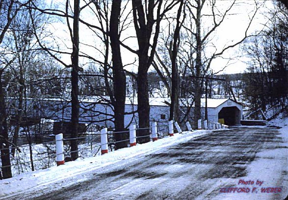 |
MARKLEY MILL, JUDGE KNIGHT BRIDGE, built in 1835, consisted of four spans, with a total length of 301 feet spanning the Perkiomen Creek near George Erb's Mill. It was removed in 1956. In 1936 it became a State bridge rather than a County bridge, but when the State announced plans to replace bridge with a modern concrete structure, the county became concerned with preserving it as a historic landmark. With a reprieve the bridge was saved for some years. With the announcement, in 1950, of plans to construct the dam at Green Lane, the future of the bridge became clouded. Photographed c.1955, by Cliff F. Weber, a classmate of mine, prior to its removal for a dam built on site by the Philadelphia Suburban Water Company. Information courtesy of a fellow member of the Pennsylvania Theodore Burr Covered Bridge Society, Abe Ludy. Thanks, Abe. |
 |
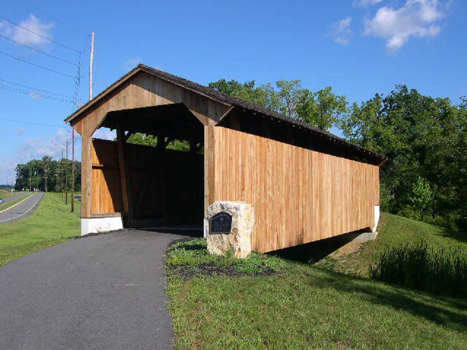
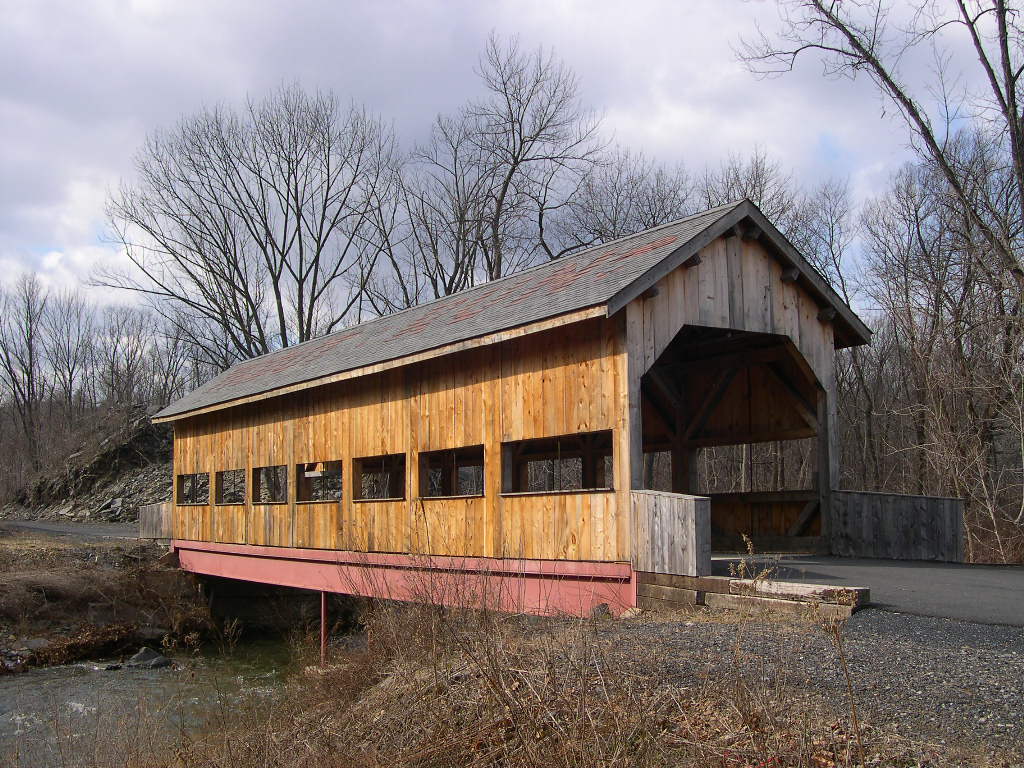
TROLLEY STOP, SKIPPACK VILLAGE BRIDGE 38-46-H, Stringer, is located on Rte 73 in Skippack. Built in 1997 by Lancaster County Amish carpenters. The GPS location is N40 13.42 W75 24.07. |
| NORTHAMPTON COUNTY |
 |
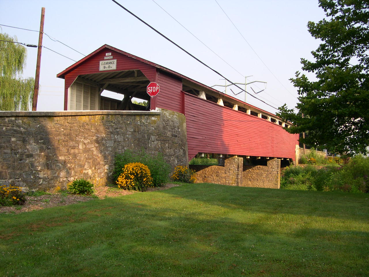
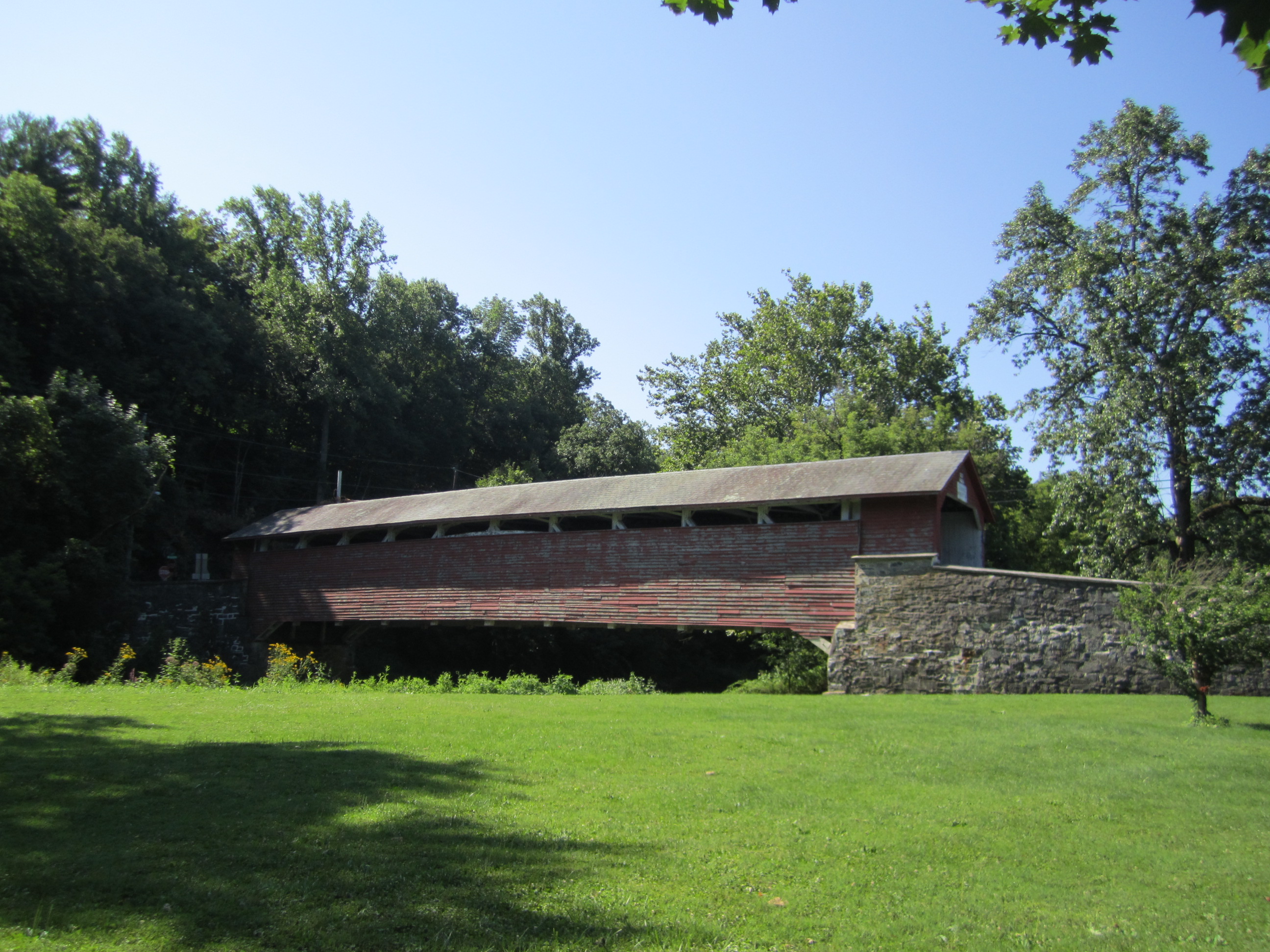
KREIDERSVILLE, SOLT'S BRIDGE 38-48-01, Burr-Arch Truss, builder unknown, built in 1840. It is located on Kreidersville Road (TR473) in Kreidersville. The GPS location is N40 43.43 W75 29.57. |
| PHILADELPHIA COUNTY |
 |
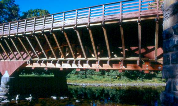
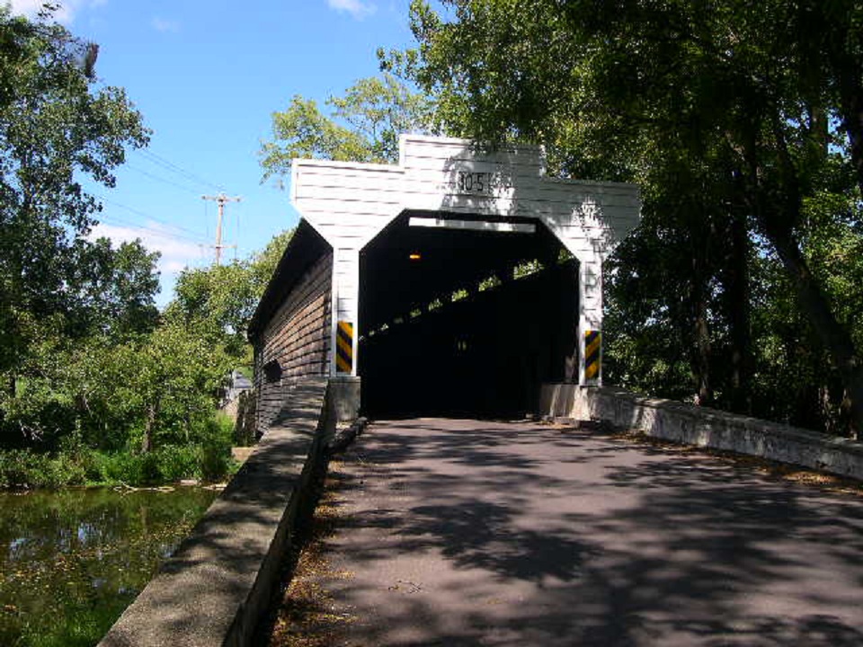
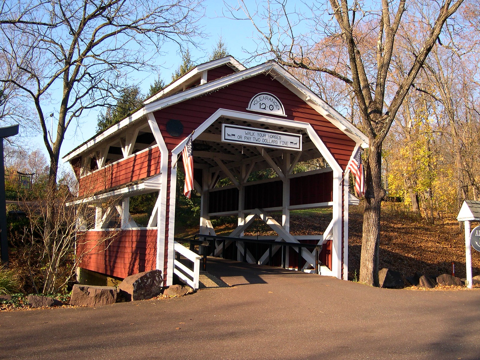
THOMAS MILL BRIDGE 38-51-01, Howe Truss, builder unknown, built in 1855, rebuilt in 1939. It underwent a $420,000.00 rehabilatation in 1999 which included a new stainless steel roof, deck, siding, and repairs to the beams at each of the four corners at the abutments. It is located in 0.6 miles into Fairmont Park in Philadelphia on a walking & jogging path on Thomas Mill Road. This photo was given to me by The First Vice President of the Theodore Burr Covered Bridge Society of PA, Jim Smedley. The GPS location is N40 04.30 W75 13.51. |
PENNSYLVANIA
|
CALIFORNIA |
CONNECTICUT
| DELAWARE | INDIANA |
MAINE | MARYLAND
MASSACHUSSETTS | NEW
HAMPSHIRE | NEW JERSEY | NEW
YORK | OHIO | RHODE
ISLAND | VERMONT
VIRGINIA | WEST VIRGINIA
| BRIDGING LINKS | HOME