COLUMBIANA
COUNTY
 |
SELLS,
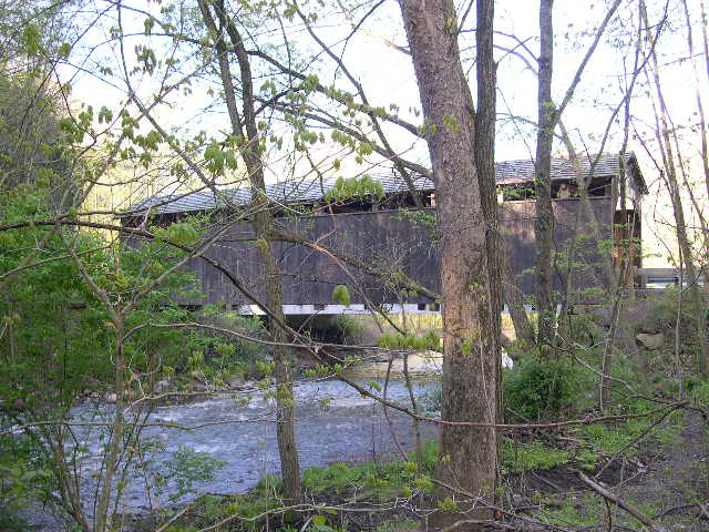
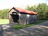
ROLLER MILL BRIDGE 35-15-01#2, Multiple Kingpost Truss, built
in 1878, removed in 1988 & rebuilt in 1995, is located NW
of Lisbon, in Scenic Vista Park.
The
GPS location is N40 44.30 W80 49.18.
|
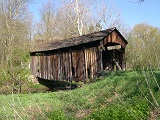 |
JIM
McCLELLAN BRIDGE 35-15-02#2, Multiple Kingpost Truss, built in
1879, rebuilt in 2017, is located SW of Lisbon, on McClellan Road.
The
GPS location is N40 43.73 W80 50.13.
|
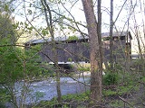 |
TEEGARDEN,
CENTENNIAL BRIDGE 35-15-05#2, Multiple Kingpost Truss, built in
1875 is located NW of Lisbon, on bypassed section of Eagleton
Road.
The
GPS location is N40 49.30 W80 49.62.
|
|
BRIDGE
GONE NO PHOTO !
|
MILLER
ROAD BRIDGE 35-15-07, Multiple Kingpost Truss, built in 1860 was
burn't down in 1995.
The
GPS location was N40 48.83 W80 46.29.
|
 |
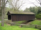
CHURCH
HILL ROAD BRIDGE 35-15-08, Kingpost Truss, built in 1875 is located
at the Western edge of Elkton, next to a restaurant, along OH154.
The
GPS location is N40 45.68 W80 42.24.
|
 |
THOMAS
J. MALONE BRIDGE 35-15-96, Altered Multiple Kingpost Truss, built
in 1865, is located NE of Liverpool, in Beaver Creek State Park.
The
GPS location is N40 43.67 W80 36.72.
|
CUYAHOGA
COUNTY
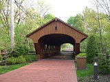 |
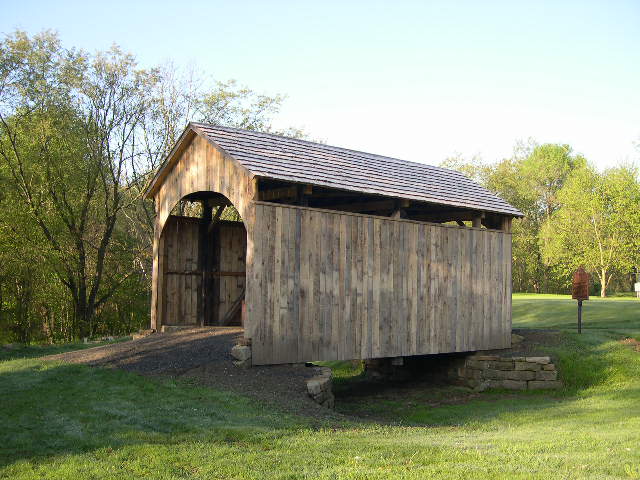
CHARLES
A. HARDING MEMORIAL BRIDGE 35-18-25, NEW Multiple Kingpost Truss,
built in 1998 & designed by John Timmer of Richland Engineering.
It is located in Olmstead Falls on Main Street.
The
GPS location is N41 22.668 W81 54.060.
|
 |
WALTER
F. EHRNFELT BRIDGE 35-18-B, Stringer, has a cement deck w/decorative
roof & walls. It is located in Berea, on Whitney Road.
The
GPS location is N41 20.571 W81 50.210.
|
GEAUGA
COUNTY
 |
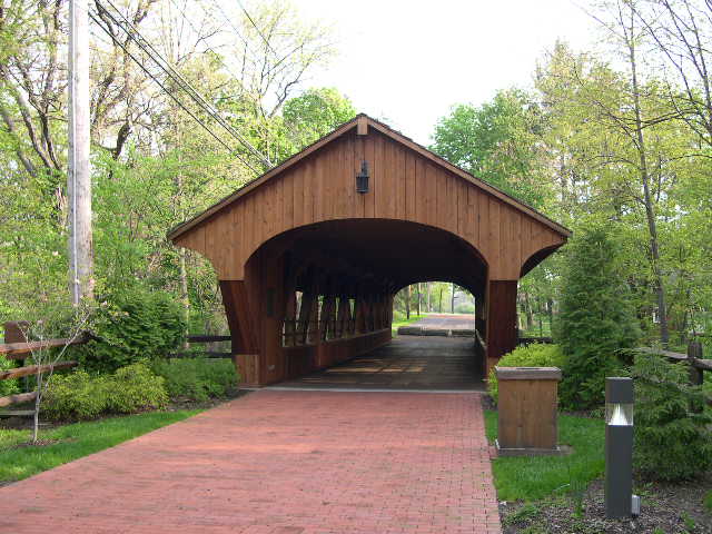
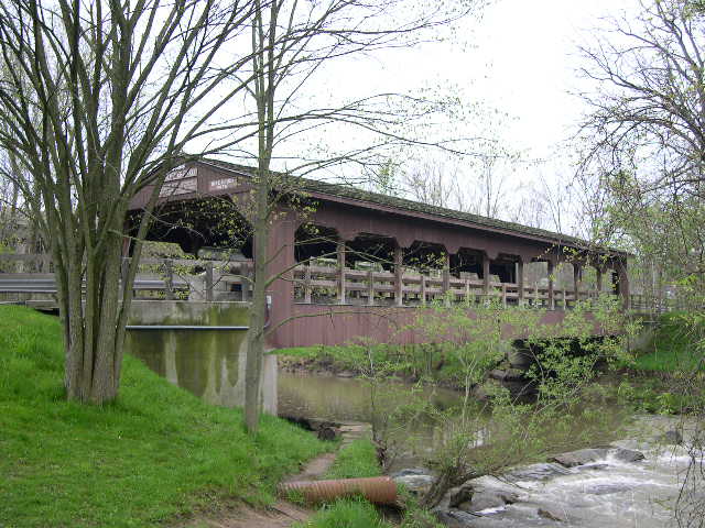
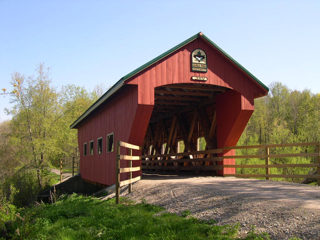
GEAUGA
PARK/TARE CREEK BRIDGE 35-28-02#2, Howe Truss built in 2004, is
located on rail trail in Geauga Park.
The
GPS location is N41 28.833 W81 05.606.
|
 |
MAPLE
HIGHLANDS TRAIL BRIDGE 35-28-04, Pratt Truss, built in 2013, is
located 2.0 miles north of Middlefield on Maple Highland Rail-Trail.
The
GPS location is N41 29.682 & W81 06.187.
|
LAKE
COUNTY
|
|
WERSCH
ESTATE BRIDGE 35-43-A, Stringer, built in 1940, is located SE
of Mentor, off Little Mountain Road (PRIVATE).
The
GPS location is N41 38.374 W81 18.902.
|
SUMMIT
COUNTY
 |
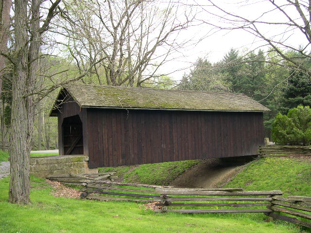
EVERETT
ROAD BRIDGE 35-77-01#2, Smith Truss, built in 1870, restored in
1986, is located SE of Richfield, on Everett Road (CR 42).
The
GPS location is N41 12.243 W81 35.008.
|
TRUMBULL
COUNTY
 |
NEWTON
FALLS, STEDMAN BRIDGE 35-78-01, Town Lattice Truss, built in 1831,
is located in the town of Newton Falls, on Arlington Street.
The
GPS location is N41 11.28 W080 58.31.
|
|