
This Region includes Orange, Rutland, & Windsor Counties!
| Orange County |
click
on small photos to see larger photo!
|
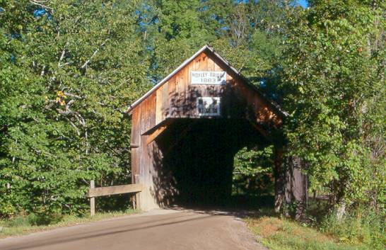 |
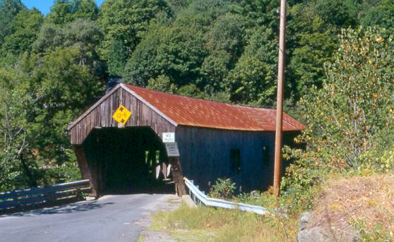
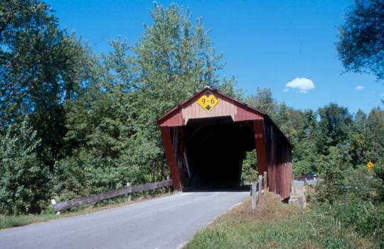
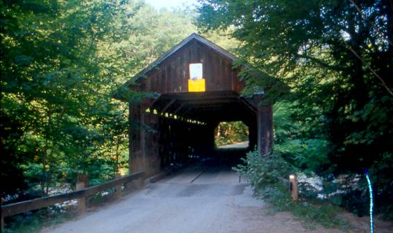
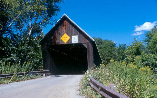
MOXLEY, GUY BRIDGE 45-09-01, Queenpost Truss, built in 1883, is located South of Chelsea, on Moxley Road. The GPS location is N43 57.417 W72 27.796. |
 |
KINGSBURY, HYDE BRIDGE 45-09-02, Multiple Kingpost Truss, built in 1904, is located North of East Bethel, on Kingsbury Road in Kingsbury. The GPS location is N43 52.854 W72 34.922. |
 |
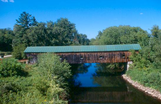
GIFFORD, C. K. SMITH BRIDGE 45-09-03, Multiple Kingpost Truss, built in 1904, is located South of East Randolph, off VT 14, on Hyde Road. The GPS location is N43 54.976 W72 33.306. |
 |
BLAISDELL, BRALEY BRIDGE 45-09-04, Multiple Kingpost Truss, built in 1904, is located South of East Randolph, off VT 14, on Braley Road. The GPS location is N43 55.711 W72 33.310. |
 |
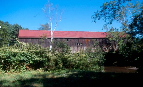
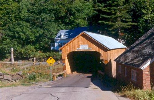
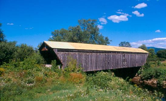
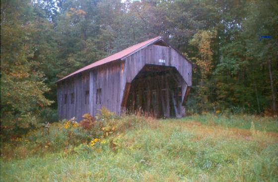
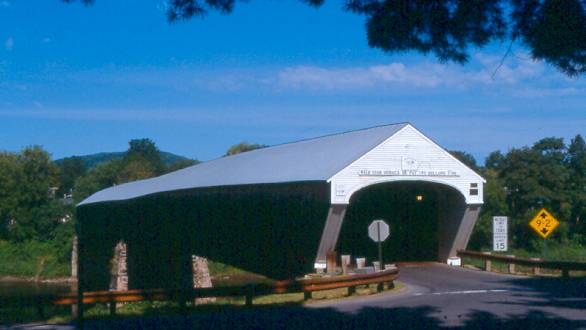
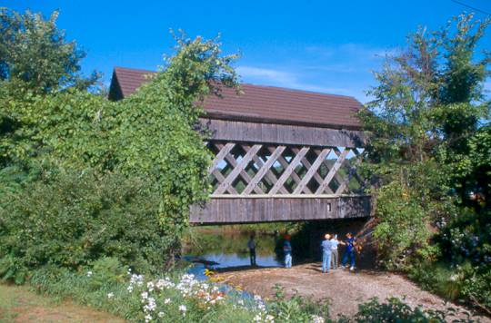
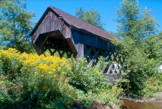
UNION VILLAGE BRIDGE 45-09-05, Multiple Kingpost Truss variation, built in 1867, is located in Union Village, on Academy Road. The GPS location is N43 47.32 W72 15.26. |
 |
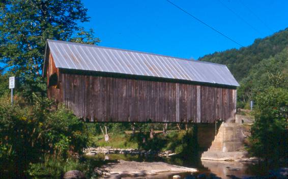
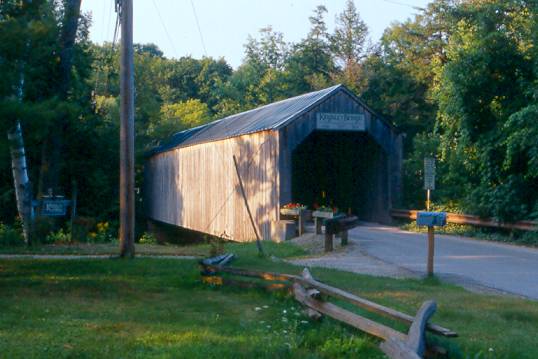
SAYRES, THETFORD CENTER BRIDGE 45-09-06, Haupt Truss variant with Arch, built in 1839, is located at the Western edge of Thetford Center, on Tucker Hill Road. The GPS location is N43 49.925 W72 15.168. |
 |
HOWE BRIDGE 45-09-07, Multiple Kingpost Truss, built in 1879, is located North of Tunbridge, off VT 110, on Belknap Brook Road. The GPS location is N43 51.893 W72 29.937. |
 |
CILLEY, LOWER BRIDGE 45-09-08, Multiple Kingpost Truss, built in 1883, is located SW of Tunbridge, on Howe Lane. The GPS location is N43 52.979 W72 30.235. |
 |
MILL, HAYWARD, NOBLE BRIDGE 45-09-09#2, Multiple Kingpost Truss, built in 2000, is located in Tunbridge, on Spring Road. The GPS location is N43 53.504 W72 29.492. |
 |
LARKIN BRIDGE 45-09-10, Multiple Kingpost Truss, built in 1902, is located NE of North Tunbridge, on Larkin Road. The GPS location is N43 55.383 W72 27.928. |
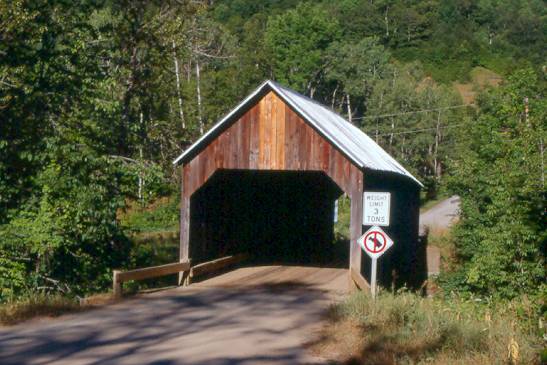 |
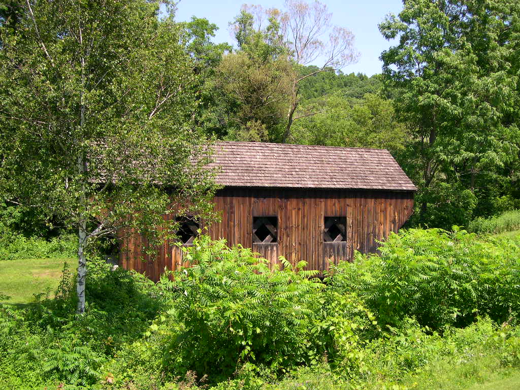
FLINT BRIDGE 45-09-11, Queenpost Truss, built in 1874, is located NNE of North Tunbridge, on Bicknell Hill Road. The GPS location is N43 56.961 W72 27.517. |
| Rutland County | |
 |
SANDERSON BRIDGE 45-11-02#2, Town Lattice Truss, built in 1838 & re-built in 2003, is located SW of Brandon, on bypassed section of Pearl Street. The GPS location is N43 47.364 W73 06.702. |
 |
KINGSLEY, MILL RIVER BRIDGE 45-11-03, Town Lattice Truss, built in 1836, is located at the Village of East Clarendon, on East Street. The GPS location is N43 31.427 W72 56.465. |
 |
GORHAM, GOODNOUGH BRIDGE 45-11-04#2, Town Lattice Truss, built in 1842 & re-built in 2004, is located North of Proctor, off VT 3, on Gorham Bridge Road. The GPS location is N43 40.802 W73 02.249. |
 |
HAMMOND BRIDGE 45-11-05, Town Lattice Truss, built in 1842, is located NW of Pittsford, on bypassed section of Kendall Hill Road. The GPS location is N43 43.238 W73 03.223. |
 |
DEPOT BRIDGE 45-11-06, Town Lattice Truss, built in 1853, is located at the Western edge of Pittsford, on Depot Hill Road. The GPS location is N43 42.569 W73 02.562. |
 |
COOLEY BRIDGE 45-11-07, Town Lattice Truss, built in 1849, is located South of Pittsford, on Elm Street. The GPS location is N43 41.422 W73 01.715. |
 |
BROWN, HOLLOW BRIDGE 45-11-09, Town Lattice Truss, built in 1880, is located East of North Clarendon, on Upper Cold River Road. It was slightly damaged by Tropical Storm Irene in 2011. The GPS location is N43 33.973 W72 55.129. |
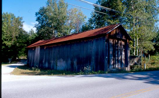 |
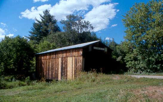
TWIN BRIDGE 45-11-10, Town Lattice Truss, built in 1850, is located North of Rutland, on east side of East Pittsford Road. It was moved there in 1947 & is being used as a storage shed for the township, its twin was destroyed years ago. The GPS location is N43 38.960 W72 58.350. |
 |
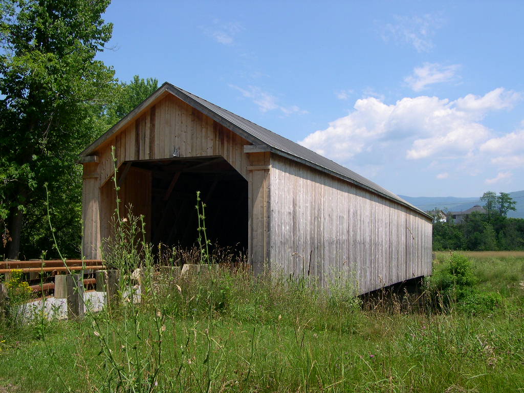
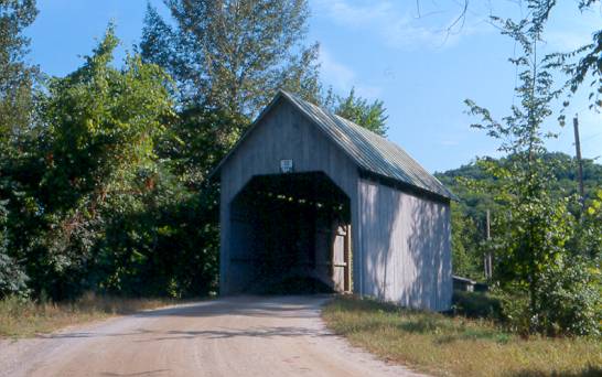
RIVERSIDE FARM BRIDGE I 45-11-2B#2, Stringer, built in 1976 by John Giorgetti, is located along Route 100 in Pittsfield. The GPS location is N43 45.861 W72 49.036. |
| Windsor County | |
 |
MARTIN'S MILL, MARTINSVILLE BRIDGE 45-14-01, Town Lattice Truss, built in 1881, is located South of Hartland on Martinsville Road. The GPS location is N43 31.941 W72 23.757. |
|
|
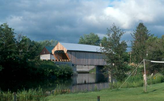
WILLIARD, NORTH HARTLAND BRIDGE 45-14-02, Town Lattice Truss, built in 1879, is located at the Western edge of North Hartland on Mill Road (Street). The
GPS location is N43 35.628 W72 20.964. NORTH HARTLAND TWIN BRIDGE 45-14-64#2, Town Lattice Truss, dedicated on October 13, 2001, built by Jan Lewandoski, Restoration and Traditional Building, Inc. is located on the Eastern edge on the same road. The GPS location is N43 35.618 W72 21.005. |
 |
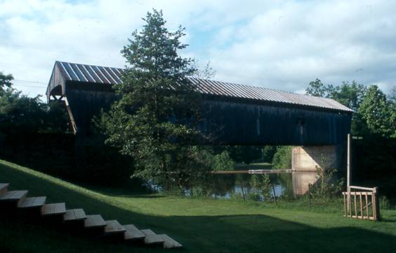
BALTIMORE BRIDGE 45-14-03, Town Lattice Truss, built in 1870, is located in Eureka Schoolhouse Park, SE of Springfield. The GPS location is N43 16.217 W72 26.899. |
 |
The GPS location is N43 22.044 W72 30.972. |
 |
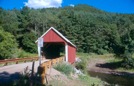
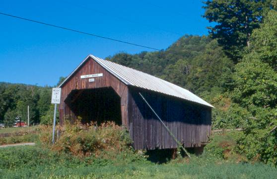
SALMOND BRIDGE 45-14-05, Multiple Kingpost Truss, built c. 1875, is located NE of Amsden on Henry Gould Road, moved there in 1986. The GPS location is N43 25.615 W72 29.300. |
 |
DOWNER'S, UPPER FALLS BRIDGE 45-14-08, Town Lattice Truss, built in 1840, is located SW of Amsden off VT 131 on Upper Falls Road. The GPS location is N43 23.907 W72 31.327. |
 |
The GPS location is N43 28.43 W72 23.04. |
 |
BEST'S, SWALLOWS BRIDGE 45-14-10, Tied Arch, built in 1889, is located WSW of Brownsville on Churchill Road. The GPS location is N43 27.306 W72 30.979. |
 |
BOWERS, BROWNSVILLE BRIDGE 45-14-11, Tied Arch, built c. 1919, is located west of Brownsville on Ely Road. The GPS location is N43 27.671 W72 29.422. |
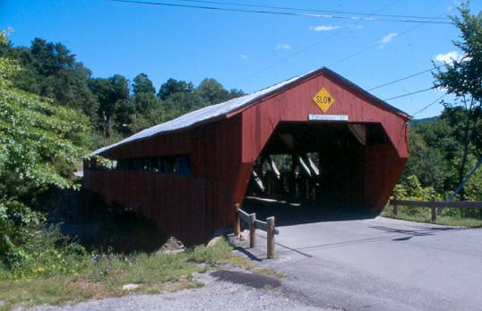 |
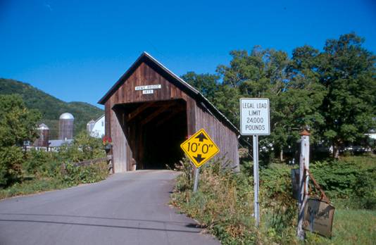
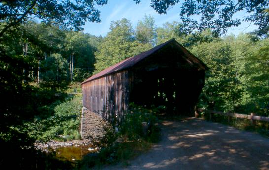
TAFTSVILLE BRIDGE 45-14-12, Multiple Kingpost Truss w/ Arch, built in 1836, is located at Taftsville on River Road. The GPS location is N43 37.849 W72 28.073. |
 |
LINCOLN BRIDGE 45-14-13, Pratt Truss w/ Arch, built in 1877, is located SW of West Woodstock off US Route 4, on Fletcher Hill Road. The GPS location is N43 36.033 W72 34.136. |
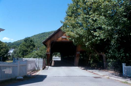 |
MIDDLE, UNION STREET BRIDGE 45-14-15, Town Lattice Truss, built in 1969, is located in Woodstock on Mountain Ave. The GPS location is N43 37.48 W72 31.236. |
 |
TWIGG-SMITH BRIDGE 45-14-17, Town Lattice Truss, originally built in Lamoille County in 1870, was cut in two halves & moved to a private road off VT 44. It was destroyed by a tornado. |
 |
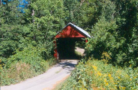
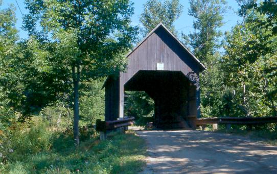
SOUTH POMFRET, TEAGO BRIDGE 45-14-18, Town Lattice Truss, originally built in Lamoille County in 1870, was cut in two halves & moved. The GPS location is N43 39.672 W72 32.260. |
 |
QUECHEE VT 45-14-A, Stringer, built by the Quechee Lakes Development Corporation in 1970. It is located on Waterman Hill Road. It is partially standing after Tropical Storm Irene on August 28, 2011 but the road was washed away on the Queechee Village side. The GPS location is N43 38.738 W72 25.136. |
Southern VT | North Central VT | Northeastern VT | Northwestern VT | HOME
PENNSYLVANIA
|
CALIFORNIA |
CONNECTICUT
| DELAWARE | INDIANA
| MAINE | MARYLAND
MASSACHUSSETTS | NEW
HAMPSHIRE | NEW JERSEY | NEW
YORK | OHIO | RHODE
ISLAND | VERMONT
VIRGINIA | WEST
VIRGINIA | BRIDGING LINKS | HOME